The completion of Charlie’s 9K trail two years ago was a real game changer for the Park City system. We were super excited about the potential this “artery trail” held, not only for dispersing use, but also in creating meaningful, exciting, new connections and loop options, both hike and bike, between the 9K, Mid Mountain Trail and existing upper elevation trails.
In mid-July, after two-plus years of planning and construction, the first of these connections, the Cyn City trail, came to its flowy fruition. The trail was named in memory of long-time local, trail advocate and mountain biking pioneer, Cyndi Schwandt. In addition to being a founding member of the Team Sugar women’s mountain biking club, Cyndi was a pioneer in women’s mountain bike racing and an early Park City trail builder.
From the start, the vision was to design a directional, mountain bike-specific trail that had the potential to serve the largest number of riders. We wanted to create something that would be more inclusive and fun for riders of varied ability levels. Since Cyndi’s untimely passing three years ago, we have been eager to recognize her enduring legacy, and this project seemed like a perfect fit. With the support from Cyndi’s family, the Utah Office of Outdoor Recreation and approval from Park City Mountain, we were green light, GO!
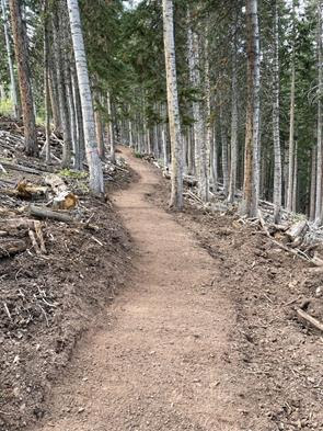
The canvas that we were immediately drawn to was the Black Forest area at Park City Mountain. Looking at topo maps, having skied the area in the winter months and ridden the nearby Black Forest bike trail, we realized that there was an opportunity to create something unique. A sustained descent of nearly three miles and 700 feet vertical, in a north-facing, partially-gladded, pine and aspen tree canopy. “Tree canopy” and “north-facing” are ideal for maintaining moisture in the trail tread and the pines typically hold the most sustainable, loamy, “hero dirt”.
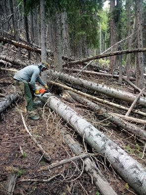
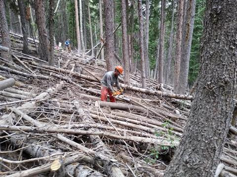
Drawing a line on a topo map is one thing but “ground-proofing” and laying out a trail on an extremely steep, 40-degree slope, with a precarious mix of thick brush and jumbled deadfall log-jams, proved to be incredibly challenging. And as we bushwhacked and performed the log-jam limbo, the Black Forest offered up some of its secrets. In between the beer cans, animal bones and lonely solo skis, we discovered a laminated photo memorial from years past, a now closed mine shaft, and most peculiar, some rotary phones mounted high up in the pines along with their cordless counterparts in their chargers, sitting upon stumps, awaiting a call. Curious indeed!
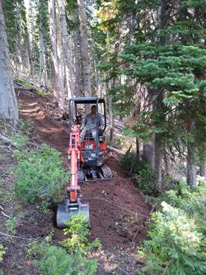
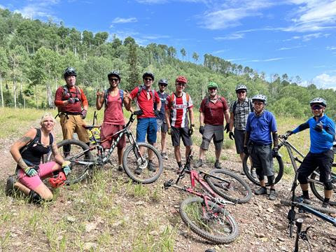
This project was truly a team effort, and I can’t give enough credit to the MTF crew members, who, over the past two summers spent many weeks with the chainsaws, removing hundreds of tangled blowdowns, clearing the way for Chase and the mini excavator. They also packed and shaped each of the 16 switchbacks, cleared back vegetation, sledge-hammered “shark fin” rocks, added drainage features (and fun features), and put the final touches on the tread to get it ride-ready.
Long-time crew member and talented trail artist, Chase Smith, used the mini excavator as a both a scalpel and a paintbrush, creating smooth, flowy lines, perfectly shaped, bermed turns that “cradle you like a baby”, in-sloped “catch berms” and exaggerated grade reversals and rollers to bump up the fun factor. There are also several strategically placed features including log, rock and root drops/jumps. The trail is, as Chase likes to describe it, “interactive”. So, while a lower intermediate rider can navigate it without feeling intimidated, a more experienced rider will quickly realize that with a few extra pedal strokes, it can be as fun or as challenging as one chooses to make it.
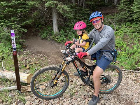
Since its completion, Cyn City has had quite the buzz about it. We have had 10-year-olds, 70-somethings, and every age and ability level in between, all grinning ear to ear, as they exit Cyndi’s trail. Our entire team is proud of what we accomplished with this challenging project and it’s incredibly rewarding to see it bring joy to so many. Simply put by Chase, after seeing the stoke that the trail has created thus far, “I think we did good.” I have no doubt that Cyndi would agree.
Trail Stats:
Type: Bike Only/Directional Down
Start: Black Forest
Finish: Mid Mountain Trail
Length: 2.52 miles (2.72 with Black Forest)
Descent: 700 feet
Number of switchbacks: 16
Loop Options:
1) 9K to Cyn, Mid Mountain to Boulder, Moosebones to Empire Pass/Bonanza Flat TH.
2) Mid Mountain to Tommy’s Two Step, Keystone, Fat Lip/Stiff Upper Lip, 9K, Corvair, back to the Mid Mtn TH.
3) Lollipop Loop: 9K to Cyn, Riser to Tommy’s Two Step, Keystone, Fat Lip/Stiff Upper Lip, 9K back to Bonanza TH.