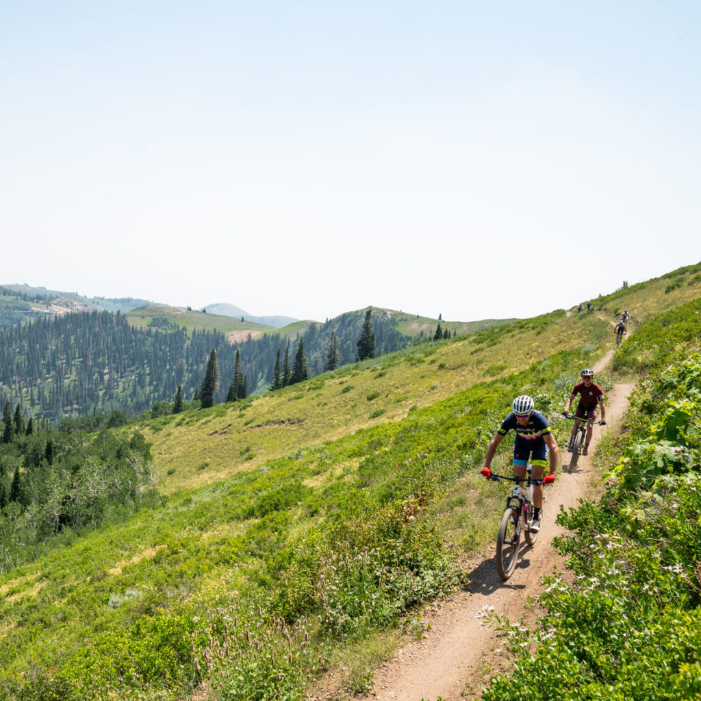
Summer Trails Overview
400 MILES OF SINGLETRACK
Park City trails are open to hiking/trail-running, mountain biking and equestrian trail users. Ranging in altitude from 6,500’ to nearly 10,000’, the trail system spans the whole environmental scale. In a single excursion, trail users can experience everything from high-desert covered in sagebrush, mountain mahogany and rabbit brush to the archetypal high-altitude alpine environment.
Park City has been recognized by the International Mountain Biking Association (IMBA) as the first Gold Level Ride Center in the world and continues to share that status with five other destinations. Both the Mid Mountain trail and the 26-mile, Park City Epic- Armstrong & Pinecone combined with the Wasatch Crest & Mid Mtn, are recognized as IMBA Epic rides.
June – November
The season for alpine trails typically begins in June and runs through early November. Snowpack and rate of spring melt significantly impact the accessibility of trails above 7,000’. Trail crews must wait until trails are dry before they can begin clearing winter blow-downs and making necessary, post-winter repairs. Trails in the lower-lying areas of Park City, such as Round Valley and Glenwild dry out and can be accessible up to six weeks earlier than on-mountain trails.
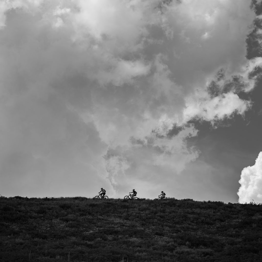
Weather
Utah is known for dynamic and severe weather, especially on the Wasatch Back. During summer months, temperatures can vary as much as 40 degrees in a single day. Summer storms, though typically brief, often cause sudden downpours of heavy rain/hail with temperatures plummeting 25+ degrees and are usually accompanied by lightning. Keep an eye on the sky. If thunderheads begin to develop it is wise to get off the mountain quickly.
⚠️Due to recent storm MTF is rescheduling this volunteer day to Next Tuesday, Aug 4th @ 5 to 8 p.m.!⚡️
✏️ Please sign up for the rescheduled Dig Day via our Facebook events page, link in our Instagram bio, or on our website under events ➡️ volunteer.
Volunteer Dig Day August 4th - Loose Moose/Silver Queen
📣 Help spread the word!
Stay safe out there!
MTF Crew

1 CommentsComment on Facebook
Brown Pow in July.. 🚲💨 How lucky are we! Perfect timing for the holiday weekend. It will be hot by the afternoons, so be prepared if you get out later in the day. We know we have mentioned it one or twice already, but seriously the wild flowers have been incredible still. 🙀🪻🪻🪻🪻
👷The crew continued maintance work on Cyn City and connecting Loose Moose to Silver Queen. Machine is off to the side on Cyn City. There were puddles there yesterday afternoon, but they will dry out promptly with the expected temps.
Shout out to our volunteers last Sunday working hard to scratch some new tread in on the foreseen hiking 9K to Mid Mountain connector . The crew followed up building a snazzy stone staircase on one of the steep rocky punches. 👏
📣Next Volunteer Dig Day is this up coming Tuesday at 5 p.m.! Don’t miss out and sign up via our Facebook events page, link in our insta bio , or on our website under events (arrow) volunteer.
🤙The crew got out to enjoy some fruits of our labor at the end of the work week. It’s a hot, sweaty, dirty, and tasking job, but the crew makes it a glamorous one! 💃
🗺️Cold hard tangible new 2026 trail maps are on deck! Get them on our website with a $30 donation for Round Valley and Old Town maps, or become a recurring member supporting trail work year round for $50 also includes our maps and a member sticker. Thank you for all your continued support! 🙏
Happy Pioneer day, don’t forget to enjoy some pie and beer! 🥧🍻
Cheers!
MTF Crew
#trailcrew #trailreport #utahtrails #getoutside #brownpow
1 CommentsComment on Facebook
📣 Looking for 30 volunteers for our next dig day! 👀
Join the crew Tuesday July 28th @ 5-8 p.m.
✏️ Sign up via our Facebook events page link in our Instagram bio, or on our website under events ➡️ volunteer.
💪We are looking forward to doing some work with y’all
#trailwork #digday #communitybuilding #volunteer #utahtrails
1 CommentsComment on Facebook
The wait is over -2026 Maps are here!! If you're a recurring donor, yours are already in the mail. Maps are also available on the donation page at www.Mountaintrails.org and will be distributed to local bike shops later next week.
1 CommentsComment on Facebook
Wowza! The wild flowers are still in full swing, so get out there this weekend! 💐 Fingers crossed 🤞 these scattered showers will dump enough precip to tame the current moon dust conditions. 🌪️
🏙️ The crew continued working their way down Cyn City. And finished trimming up Corvair 🪚
🫎 Machine and handwork also continued on the 2nd phase of Silver Queen to Loose Moose Connector.
Join us in our next Volunteer Dig Day opportunity this Sunday at 9 a.m. working on a fun hand dug hiking trail project! For more information or to sign up via our Facebook events page, link in our insta bio , or on our website under events (arrow) volunteer.
Enjoy the weekend!
MTF
5 CommentsComment on Facebook
Get Trail Maps and Trail Guides
We have paper maps as well as Prime Cuts guides for sale all over town (check your local bike shop). Or you may join the MTF and select maps and guides as your membership gift. We also have a variety of interactive map products you can use for free!
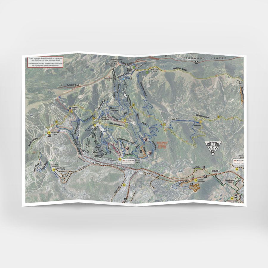
Maps
The most detailed, easiest to read maps can be sent to members with a minimum donation of $30.
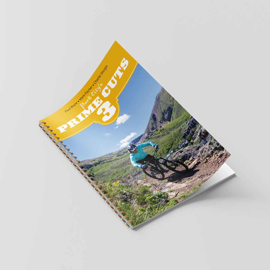
Prime Cuts Guide Book
Prime Cuts 3 is THE guide book to the Park City area’s hiking, biking, mining history, flora and other tips from locals. The full guide will sent to members with a minimum donation of $30.
We also have an abbreviated online version for FREE!
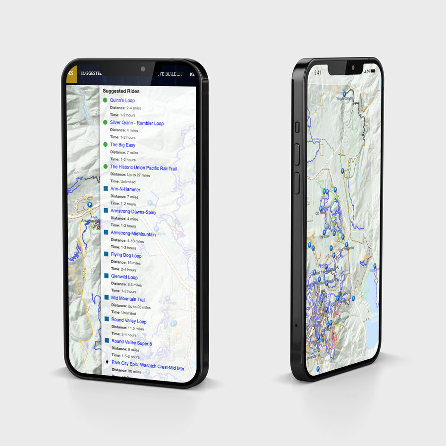
Interactive Maps
Our custom interactive map is available on our website year round for free. It includes suggested routes and a custom route builder.