NEWS: Posted on April 6, 2022
It’s Mud Season Along the Wasatch Back
By Rick Fournier, Field Manager


With the recent record-breaking high temps pushing 70 recently, we have gone straight from winter to full-blown mud season, seemingly overnight. While we’re all chomping at the bit to transition straight from white, to brown pow, we must remind ourselves that it’s only the first week of April and the weather can, and no doubt will, turn on a dime here along the Wasatch Back.
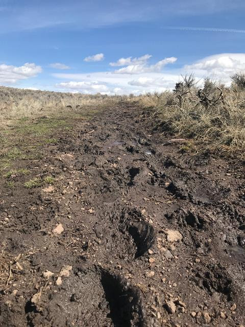
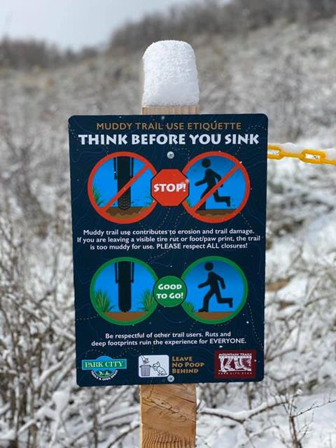
We hate to get preachy but every spring as the temps rise, and the dirt reappears, we find ourselves trying to educate trail users and discourage muddy trail use. It’s a pretty straightforward concept, really. ANY kind of soil displacement will lead to erosion and trail damage. Low spots and ruts created by foot, paw or tire, are ALL culprits. That said, we strongly encourage ALL trail users (yes, that means you too, hikers, runners and dog walkers) to turn around if it’s sticking to heels, wheels or paws. And walking/running or riding around the muddy spots is never ok as it damages vegetation and widens the trail. Let’s keep our singletrack “single”.
This time of year, “variable” and “aspect-dependent” are the words of choice when describing lower elevation trail conditions. On any given trail you can, and will go from south-facing and bone-dry, to north-facing and snow-covered or “snud” a snow/mud mix, everywhere in-between. While there are some trails that may be mostly good to go, you typically cannot piece together any measurable singletrack without hitting significant mud/snow. So, when you see a closure up at the trailhead and dry ground just on the other side of the closure, don’t assume that the rest of the trail, or the trail system as a whole, is also good to go.
It’s good to have options…
If you’re a long-time local, you already know that there is no better time than spring, to venture down to the desert for some red rock trail adventures in Moab, St. George/Hurricane or Fruita. Looking for some great, low-impact, early season trail options locally? We have well over 30 miles of natural-surface and paved pathways in the greater Park City area. And let’s not forget the 27-mile-long, Union Pacific Rail Trail – all of it in Summit County!
Trail Condition Info…
While it will never be a perfect system, we’ll continue to do our best to keep you in the know on changing conditions. As you may already know, we regularly post condition updates on our Facebook page and website, but here are a few additional resources…
You can get a visual look at conditions by going to our website; https://mountaintrails.org, clicking on the “Trails and Maps” dropdown, and then click “Interactive Map” followed by “Conditions”.
For the Snyderville Basin Area trails go to:https://www.
What’s the big deal about muddy trail use? Here are a few older, but still pertinent posts, that will shed some mud, and hopefully some light. The first is spot on for Park City…
http://parkcitymountainbike.
Rick, Trails Manager
